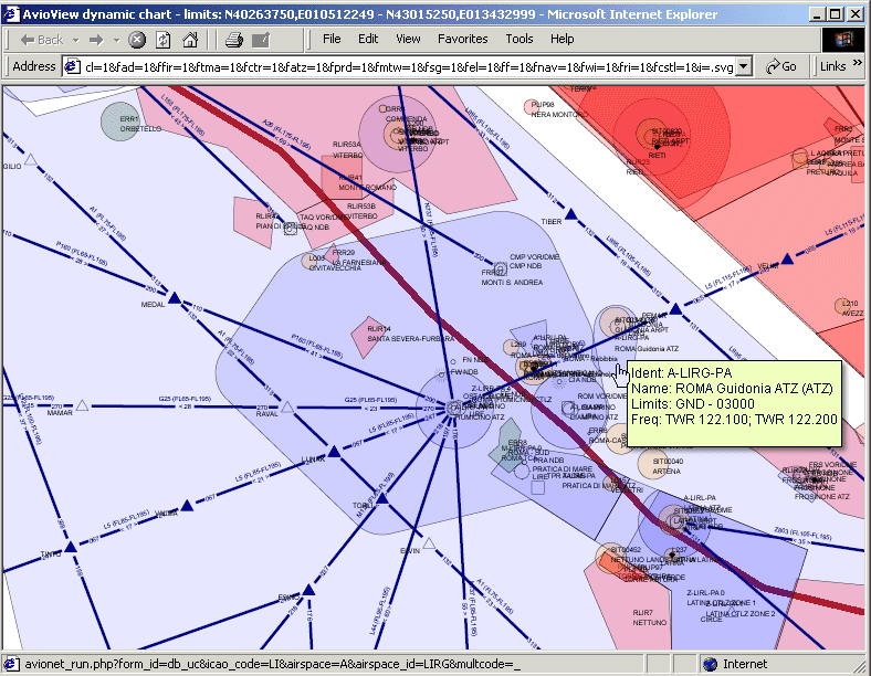
The charting subsystem
In this image we selected to include also airspaces in the generated map.
[<<] Previous | [>>] Next